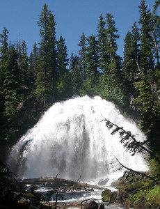
 Chush Falls
Rating: ****
Form: fan
Magnitude: 56
Access: high-clearance and trail (page 320)
USGS Map: Trout Creek Butte (1988 nl)
Edition: 5th
Chush Falls
Rating: ****
Form: fan
Magnitude: 56
Access: high-clearance and trail (page 320)
USGS Map: Trout Creek Butte (1988 nl)
Edition: 5th
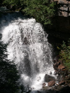 The Cascades
Rating: **
Form: plunge
Magnitude: 49
Access: high-clearance and trail (page 320)
USGS Map: Trout Creek Butte (1988 ns)
Edition: 5th
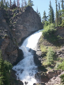 Upper Chush Falls
Rating: *****
Form: fan
Magnitude: 56
Access: high-clearance and trail (page 321)
USGS Map: Trout Creek Butte (1988)
Edition: 5th
Others
Although in the vicinity of the new entries listed above, there is no easy access to Park Creek Falls (u), USGS Trout Creek Butte (1988 nl),
Upper South Fork Falls (u), USGS Trout Creek Butte (1988 nl), or
Lower South Fork Falls (u), USGS Trout Creek Butte (1988 nl).
COPYRIGHT 2013 by Gregory A. Plumb
GUIDEBOOK published by
Mountaineers Books