A Waterfall Lover's Guide to the Pacific Northwest 5th ed.
Inland Empire
13 St. Mary's
Waterfall Entries (refer to hardcopy
book for descriptions and directions; page numbers are provided below)
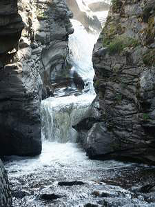 Mission Falls
Rating: **
Form: tiered
Magnitude: 38
Access: bushwhack (page 195)
USGS Map: Omak Lake (1980)
Edition: 4th
Go to next section of Inland Empire
Go to previous section of Inland Empire
Inland Empire Contents
Inland Empire Index
Master Table of Contents
Master Index
Perform a Selective Search
View Chronological List of Additions
View Chronological List of Updates
Place
a Book Order Online
COPYRIGHT 2013 by Gregory A. Plumb
GUIDEBOOK published by
Mountaineers Books