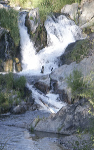
 Chamokane Falls
Rating: **
Form: segmented
Magnitude: 35
Access: trail (page 183)
USGS Map: Long Lake (1973)
Edition: 1st
UPDATE: This waterfall is now only accessible to tribal citizens.
Chamokane Falls
Rating: **
Form: segmented
Magnitude: 35
Access: trail (page 183)
USGS Map: Long Lake (1973)
Edition: 1st
UPDATE: This waterfall is now only accessible to tribal citizens.
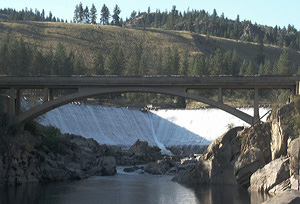 Little Falls
Rating: ***
Form: block
Magnitude: 51 (h)
Access: auto (page 183)
USGS Map: Little Falls (1973 ns)
Edition: 1st
Others
Field truthing revealed Little Chamokane Falls, USGS Wellpinit (1973), is not accessible via Martha Boardman Road.
COPYRIGHT 2024 by Gregory A. Plumb
GUIDEBOOK published by
Mountaineers Books