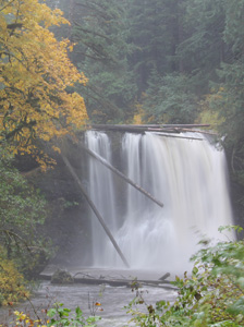
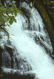
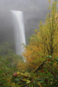
 Upper North Falls
Rating: ***
Form: plunge
Magnitude: 68
Access: trail (page 264)
USGS Map: Elk Prairie (1985)
Edition: 1st
Upper North Falls
Rating: ***
Form: plunge
Magnitude: 68
Access: trail (page 264)
USGS Map: Elk Prairie (1985)
Edition: 1st
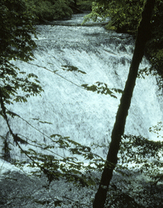
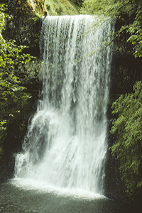
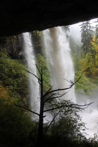 North Falls
Rating: ****
Form: plunge
Magnitude: 76
Access: trail (page 264)
USGS Map: Elk Prairie (1985)
Edition: 1st
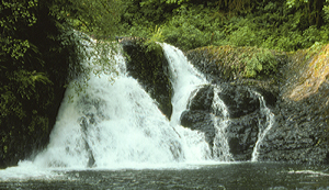 Twin Falls
Rating: **
Form: segmented
Magnitude: 45
Access: trail (page 265)
USGS Map: Drake Crossing (1985)
Edition: 1st
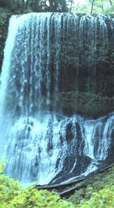 Middle North Falls
Rating: ***
Form: plunge
Magnitude: 42
Access: trail (page 266)
USGS Map: Drake Crossing (1985)
Edition: 1st
 Drake Falls
Rating: **
Form: horsetail
Magnitude: 35
Access: trail (page 266)
USGS Map: Drake Crossing (1985)
Edition: 1st
 Double Falls
Rating: ***
Form: tiered
Magnitude: 37 (l)
Access: trail (page 266)
USGS Map: Drake Crossing (1985)
Edition: 1st
 Lower North Falls
Rating: **
Form: block
Magnitude: 63
Access: trail (page 267)
USGS Map: Drake Crossing (1985)
Edition: 1st
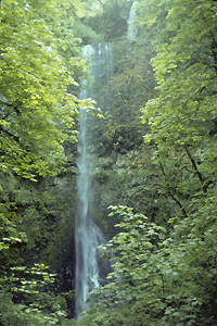
 Winter Falls
Rating: **
Form: plunge
Magnitude: 33 (l)
Access: trail (page 267)
USGS Map: Drake Crossing (1985)
Edition: 1st
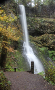
 South Falls
Rating: *****
Form: plunge
Magnitude: 82
Access: trail (page 267)
USGS Map: Drake Crossing (1985)
Edition: 1st
 Lower South Falls
Rating: ***
Form: plunge
Magnitude: 75
Access: trail (page 267)
USGS Map: Drake Crossing (1985)
Edition: 1st
More
Click Here for Frenchie Falls, USGS Drake Crossing (1985 ns).
Output the CLICK HERE page to match your hardcopy book by changing your printer settings to 9" x 5 3/4".
Others
Located outside of Silver Creek Falls State Park, Drift
Creek
Falls, USGS Drake Crossing (1985) was not accessible when field-truthed.
COPYRIGHT 2013 by Gregory A. Plumb
GUIDEBOOK published by
Mountaineers Books