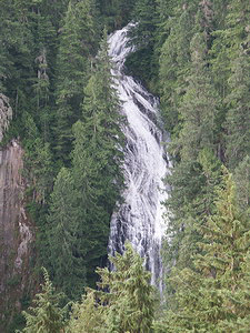
 Lava
Creek Falls
Lava
Creek Falls
Rating: ***
Form: horsetail
Magnitude: 86
Access: auto (page 142)
USGS Map: Ohanapechosh Hot Springs (1989 nl)
Edition: 1st
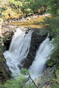 Upper Falls (u)
Rating: **
Form: segmented
Magnitude: 35
Access: auto (page 143)
USGS Map: Ohanapecosh Hot Springs (1989 ns)
Edition: 1st
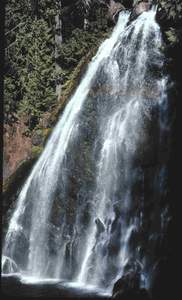 Thunder
Falls
Thunder
Falls
Rating: ***
Form: fan
Magnitude: 72
Access: trail and bushwhack (page 143)
USGS Map: Ohanapecosh Hot Springs (1989 ns)
Edition: 1st
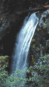 Fish
Ladder Falls
Fish
Ladder Falls
Rating: ***
Form: horsetail
Magnitude: 48
Access: bushwhack (page 143)
USGS Map: Ohanapecosh Hot Springs (1989)
Edition: 1st
More
Click Here for Grant Purcell Falls, USGS Ohanapecosh Hot Springs (1989)
Output the CLICK HERE page to match your hardcopy book by changing your printer settings to 9" x 5 3/4".
Go to next section of Mount Rainier
Go to previous section of Mount Rainier
Mount Rainier Contents
Mount Rainier Index
Master Table of Contents
Master Index
Perform a Selective Search
View Chronological List of Additions
View Chronological List of Updates
Place a Book Order Online
COPYRIGHT 2013 by Gregory A. Plumb
GUIDEBOOK published by
Mountaineers Books