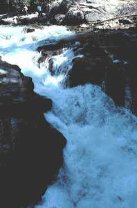
 White River Falls
Rating: ***
Form: punchbowl
Magnitude: 53 (h)
Access: trail (page 47)
USGS Map: Mount David (1989)
Edition: 1st
White River Falls
Rating: ***
Form: punchbowl
Magnitude: 53 (h)
Access: trail (page 47)
USGS Map: Mount David (1989)
Edition: 1st
More
Click Here for Little Wenatchee Falls (u), USGS Mount Howard (1989 ns).
Output the CLICK HERE page to match your hardcopy book by changing your printer settings to 9" x 5 3/4".
COPYRIGHT 2013 by Gregory A. Plumb
GUIDEBOOK published by
Mountaineers Books