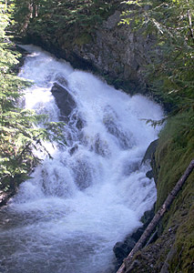
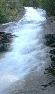
 Hunt Creek Falls
Rating: ***
Form: fan
Magnitude: 42
Access: trail (page 337)
USGS Map: Priest Lake SE (1996 ns)
Edition: 5th
Hunt Creek Falls
Rating: ***
Form: fan
Magnitude: 42
Access: trail (page 337)
USGS Map: Priest Lake SE (1996 ns)
Edition: 5th
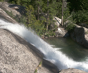 Lower Lion Creek Falls (u)
Rating: ***
Form: punchbowl
Magnitude: 40
Access: high-clearance and trail (page 337)
USGS Map: Smith Peak (1996 ns)
Edition: 5th
 Middle Lion Creek Falls (u)
Rating: ***
Form: rapids
Magnitude: 15
Access: high-clearance and trail (page 338)
USGS Map: Smith Peak (1996 ns)
Edition: 5th
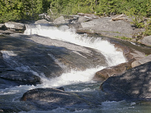
 Slippery Rocks (u)
Rating: ***
Form: cascade
Magnitude: 33
Access: high-clearance and trail (page 338)
USGS Map: Smith Peak (1996 ns)
Edition: 5th
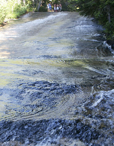
 Kent Creek Falls (u)
Rating: ****
Form: horsetail
Magnitude: 33
Access: high-clearance and trail (page 339)
USGS Map: Smith Peak (1996 ns)
Edition: 5th
Others COPYRIGHT 2013 by Gregory A. Plumb
Use the following Waterfalls for Intrepid Explorers hyperlink to access an index for information on exploring the following waterfall yet to be visited by the author:
Lion Creek Falls (u), USGS Smith Peak (1996 ns)
No roads or trails are shown on the topographic map for
Caribou Falls, USGS Caribou Creek (1996).
Go to next section of Idaho Panhandle
Go to previous section of Idaho Panhandle
Idaho Panhandle Contents
Idaho Panhandle Index
Master Table of Contents
Master Index
Perform a Selective Search
View Chronological List of Additions
View Chronological List of Updates
Place
a Book Order Online
GUIDEBOOK published by
Mountaineers Books