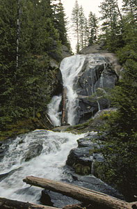
A Waterfall Lover's Guide to the Pacific Northwest 4th ed.
Idaho Panhandle 
6 Bonners Ferry
Waterfall Entries (refer to hardcopy book for descriptions and directions; page numbers are provided below)

Lower Snow Creek Falls (u)
Rating: **
Form: segmented
Magnitude: 64
Access: trail (page 289)
USGS Map: Moravia (1996 ns)


Snow Creek Falls
Rating: **
Form: fan
Magnitude: 40
Access: trail (page 289)
USGS Map: Moravia (1996)
Update: This entry can now be seen close-up. Travel 1.2 miles along Road #402 and park along a wide spot along the left side of the route near the signed trailhead. Walk 0.6 miles down the trail and turn left at spur signed Lower Falls. From here, it is 0.2 miles further to a deckside view of the 25 to 35-foot drop. Notice the spray from ABOVE the falls. Check out the new entries to find out where it's coming from.


New Entries
Click Here for Upper Snow Creek Falls (u), USGS Moravia (1996 nl).
Click Here for Middle Snow Creek Falls (u), USGS Moravia (1996 ns).
Click Here for Myrtle Creek Falls, USGS Moravia (1996 ns).
Format the page to match your hardcopy book by changing your printer settings to 9" x 5 3/4".

Others
Update: No access could be found to Highland Creek Falls (u), USGS Naples (1996 nl), when field-truthed in August, 2011.


Go to next section of Idaho Panhandle
Go to previous section of Idaho Panhandle
Idaho Panhandle Contents
Idaho Panhandle Index
Master Table of Contents
Master Index
Perform a Selective Search
View Chronogical List of Additions
View Chronogical List of Updates
Place a Book Order Online

Copyright 2011 by Gregory A. Plumb
GUIDEBOOK published by Mountaineers Books