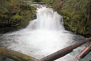
 Whitehorse Falls
Rating: **
Form: punchbowl
Magnitude: 37
Access: auto (page 305)
USGS Map: Garwood Butte (1985)
Edition: 1st
Whitehorse Falls
Rating: **
Form: punchbowl
Magnitude: 37
Access: auto (page 305)
USGS Map: Garwood Butte (1985)
Edition: 1st
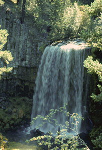
![]() Clearwater Falls
Clearwater Falls
Rating: **
Form: segmented
Magnitude: 48
Access: trail (page 306)
USGS Map: Diamond Lake (1998)
Edition: 1st
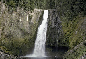 Lemolo Falls
Rating: ****
Form: horsetail
Magnitude: 75 (h)
Access: trail (page 306)
USGS Map: Lemolo Lake (1998)
Edition: 1st
 Warm Springs Falls
Rating: ***
Form: block
Magnitude: 68
Access: trail (page 307)
USGS Map: Lemolo Lake (1998 ns)
Edition: 2nd
More
Click Here for Cow Creek Falls, USGS Cedar Springs Mtn (1998 ns).
Output the CLICK HERE page to match your hardcopy book by changing your printer settings to 9" x 5 3/4".
COPYRIGHT 2013 by Gregory A. Plumb
GUIDEBOOK published by
Mountaineers Books