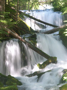
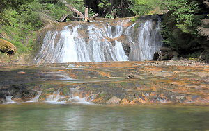
 Big Spring Creek Falls (u)
Rating: **
Form: tiered
Magnitude: 23
Access: auto (page 164)
USGS Map: Mount Adams West (2000 ns)
Edition: 5th
Big Spring Creek Falls (u)
Rating: **
Form: tiered
Magnitude: 23
Access: auto (page 164)
USGS Map: Mount Adams West (2000 ns)
Edition: 5th
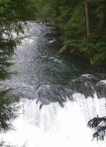
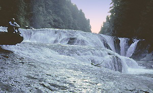
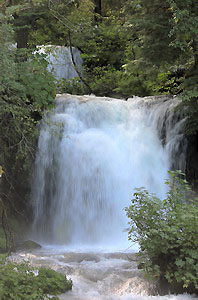 Twin Falls
Rating: **
Form: tiered
Magnitude: 64
Access: auto (page 164)
USGS Map: Steamboat Mtn (2000)
Edition: 2nd
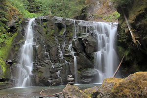 Pin Creek Falls (u)
Rating: ***
Form: block
Magnitude: 64
Access: bushwhack (page 164)
USGS Map: Steamboat Mtn (2000 ns)
Edition: 5th
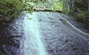
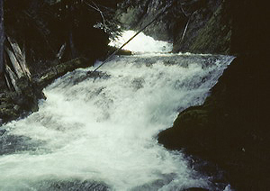 Straight Creek Falls
Rating: **
Form: rapids
Magnitude: 30
Access: trail (page 164)
USGS Map: Quartz Creek Butte (2011 ns)
Edition: 1st
 Quartz Creek Falls (u)
Rating: ***
Form: block
Magnitude: 53
Access: trail & bushwhack (page 165)
USGS Map: Quartz Creek Butte (2011 ns)
Edition: 5th
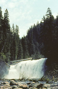
 Taitnapum Falls
Rating: ***
Form: block
Magnitude: 70
Access: trail (page 165)
USGS Map: Quartz Creek Butte (2011 ns)
Edition: 3rd
 Upper Lewis Falls
Rating: ***
Form: block
Magnitude: 65
Access: trail (page 165)
USGS Map: Quartz Creek Butte (2011)
Edition: 1st
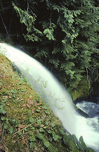 Copper Creek Falls
Rating: **
Form: punchbowl
Magnitude: 44
Access: trail (page 166)
USGS Map: Quartz Creek Butte (2011 nl)
Edition: 1st
 Middle Lewis Falls
Rating: **
Form: block
Magnitude: 56
Access: trail (page 167)
USGS Map: Quartz Creek Butte (2011)
Edition: 3rd
 Lower Copper Creek Falls (u)
Rating: **
Form: block
Magnitude: 29
Access: trail (page 167)
USGS Map: Quartz Creek Butte (2011 ns)
Edition: 3rd
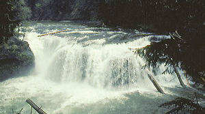 Lower Lewis Falls
Rating: ****
Form: block
Magnitude: 67
Access: auto (page 167)
USGS Map: Spencer Butte (1998)
Edition: 1st
Others
Located downstream from Straight Creek Falls (described earlier), it is only possible to see the top of Junction Falls (u), USGS Quartz Creek Butte (2011 ns).
Section Line Falls (u), USGS
Steamboat Mtn (2000 nl), is in terrain too dangerous for most people to access. Seasonal Snagtooth Creek Falls (u), USGS Quartz Creek Butte (2011 nl), is probably over 300 feet high, but it is not accessible.
COPYRIGHT 2013 by Gregory A. Plumb
GUIDEBOOK published by
Mountaineers Books