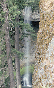
 West
Quartz Creek Falls
West
Quartz Creek Falls
Rating: **
Form: plunge
Magnitude: 35 (l)
Access: trail (page 137)
USGS Map: Mount Clifty (1987 ns)
Edition: 3rd
West
Quartz Creek Falls
Rating: **
Form: plunge
Magnitude: 35 (l)
Access: trail (page 137)
USGS Map: Mount Clifty (1987 ns)
Edition: 3rd
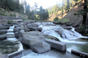 Salmon Falls
Rating: **
Form: block
Magnitude: 23
Access: auto (page 137)
USGS Map: Mount Clifty (1989 ns)
Edition: 5th
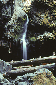 Lower
Devil Creek Falls (u)
Lower
Devil Creek Falls (u)
Rating: **
Form: tiered
Magnitude: 16 (l)
Access: trail (page 137)
USGS Map: Cliffdell (2000 nl)
Edition: 1st
More
Click Here for Horsetail Falls, USGS Cliffdell (2000 nl).
Output the CLICK HERE page to match your hardcopy book by changing your printer settings to 9" x 5 3/4".
Others
Devil Creek Falls, USGS Cliffdell (2000), is 0.4 miles upstream
from Boulder Cave, but there is no developed access. Wenas Creek
Falls (u), USGS Manastash Lake (2000 nl) is not likely accessible.
COPYRIGHT 2013 by Gregory A. Plumb
GUIDEBOOK published by
Mountaineers Books