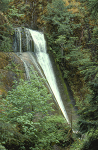
 Wolf Creek Falls
Rating: ***
Form: tiered
Magnitude: 26 (l)
Access: trail (page 295)
USGS Map: Red Butte (1997)
Edition: 1st
Wolf Creek Falls
Rating: ***
Form: tiered
Magnitude: 26 (l)
Access: trail (page 295)
USGS Map: Red Butte (1997)
Edition: 1st
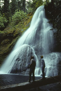
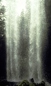
 Hemlock Falls
Rating: **
Form: horsetail
Magnitude: 63
Access: trail (page 295)
USGS Map: Quartz Mtn (1997)
Edition: 1st
Image courtesy of Greg Lief
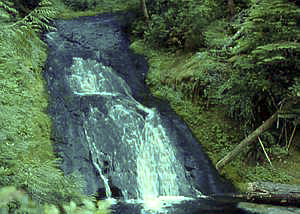
 Tributary Falls (u)
Rating: **
Form: horsetail
Magnitude: 40
Access: trail (page 296)
USGS Map: Quartz Mtn (1997 ns)
Edition: 3rd
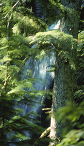
 Middle Hemlock Falls (u)
Rating: **
Form: tiered
Magnitude: 41
Access: trail (page 297)
USGS Map: Quartz Mtn (1997 nl)
Edition: 3rd
 Clover Falls
Rating: ***
Form: plunge
Magnitude: 43
Access: trail (page 297)
USGS Map: Quartz Mtn (1997 nl)
Edition: 3rd
 Yakso Falls
Rating: ***
Form: fan
Magnitude: 71
Access: trail (page 297)
USGS Map: Quartz Mtn (1997)
Edition: 1st
 Grotto Falls
Rating: ***
Form: segmented
Magnitude: 37 (l)
Access: trail (page 297)
USGS Map: Mace Mtn (1997)
Edition: 1st
More
Click Here for Cedar Creek Falls, USGS Taft Mtn (1997 ns).
Output the CLICK HERE page to match your hardcopy book by changing your printer settings to 9" x 5 3/4".
Others
No access could be found to Emile Falls, USGS
Mace Mtn (1997), when last field-truthed.
COPYRIGHT 2013 by Gregory A. Plumb
GUIDEBOOK published by
Mountaineers Books