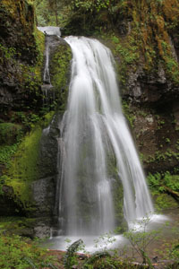
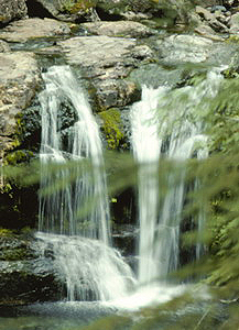
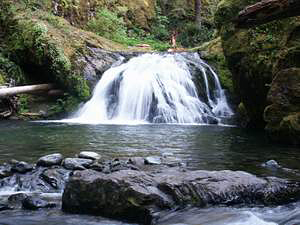
 Wildwood Falls
Rating: **
Form: punchbowl
Magnitude: 34
Access: auto (page 292)
USGS Map: Culp Creek (1986)
Edition: 2nd
Wildwood Falls
Rating: **
Form: punchbowl
Magnitude: 34
Access: auto (page 292)
USGS Map: Culp Creek (1986)
Edition: 2nd
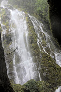
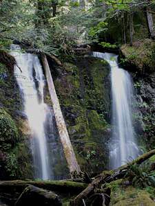
 Spirit Falls
Rating: ***
Form: fan
Magnitude: 34 (l)
Access: trail (page 292)
USGS Map: Rose Hill (1998)
Edition: 2nd
Image of falls in mid-springtime at moderate flow
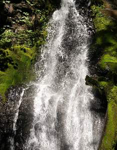
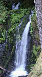
 Moon Falls
Rating: **
Form: fan
Magnitude: 24 (t)
Access: trail (page 292)
USGS Map: Holland Point (1997)
Edition: 2nd
Image of falls in mid-springtime at moderate flow
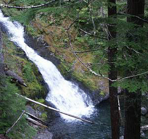
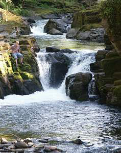 Brice Creek Falls
Rating: **
Form: punchbowl
Magnitude: 29
Access: trail (page 293)
USGS Map: Rose Hill (1998 ns)
Edition: 4th
 Trestle Creek Falls
Rating: ***
Form: fan
Magnitude: 58
Access: hike (page 293)
USGS Map: Rose Hill (1998 ns)
Edition: 4th
Update: GNIS lists the name as Lower Trestle Creek Falls.
 Smith Falls
Rating: **
Form: segmented
Magnitude: 42
Access: high-clearance (page 294)
USGS Map: Fairview Peak (1997)
Edition: 2nd
 Parker Falls
Rating: ***
Form: segmented
Magnitude: 41
Access: trail (page 294)
USGS Map: Holland Point (1997 nl)
Edition: 4th
Update: GNIS lists the name as Lower Parker Falls.
 Upper Parker Falls
Rating: **
Form: fan
Magnitude: 22
Access: trail (page 294)
USGS Map: Holland Point (1997 nl)
Edition: 4th
 Evergreen Falls (u)
Rating: **
Form: tiered
Magnitude: 35
Access: auto (page 294)
USGS Map: Holland Point (1997 ns)
Edition: 4th
 Blue Hole Falls (u)
Rating: ***
Form: punchbowl
Magnitude: 39
Access: trail (page 295)
USGS Map: Holland Point (1997 ns)
Edition: 4th
More
Click Here for Pinard Falls, USGS Holland Point (1997 ns). NEW!
Output the CLICK HERE page to match your hardcopy book by changing your printer settings to 9" x 5 3/4".
Others
Use the following Waterfalls for Intrepid Explorers hyperlink to access an index for information on exploring the following waterfall:
Upper Trestle Creek Falls, USGS Rose Hill (1998 ns)
Grouse Mountain Falls, USGS Bearbones Mtn (1997), is probably not accessible.
COPYRIGHT 2013 by Gregory A. Plumb
GUIDEBOOK published by
Mountaineers Books