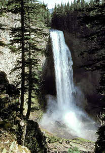
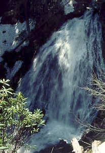
 Salt Creek Falls
Rating: *****
Form: plunge
Magnitude: 98 (h)
Access: auto (page 289)
USGS Map: Diamond Peak (1997)
Edition: 1st
Salt Creek Falls
Rating: *****
Form: plunge
Magnitude: 98 (h)
Access: auto (page 289)
USGS Map: Diamond Peak (1997)
Edition: 1st
 Lower Diamond Creek Falls
Rating: **
Form: tiered
Magnitude: 82
Access: trail (page 289)
USGS Map: Diamond Peak (1997 nl)
Edition: 2nd
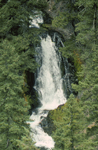
 Diamond Creek Falls
Rating: ****
Form: fan
Magnitude: 72
Access: trail (page 291)
USGS Map: Diamond Peak (1997 nl)
Edition: 2nd
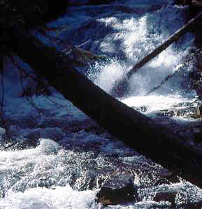 Lower Fall Creek Falls (u)
Rating: **
Form: tiered
Magnitude: 45
Access: trail (page 291)
USGS Map: Diamond Peak (1997 ns)
Edition: 1st
Update: This entry was found several decades ago while trying to navigate over snow covering the trail. Based upon reports from others having difficultly finding the drop, it's likely I wasn't even on the trail (but rather simply trekking along the canyon rim) when it was encountered.
 Fall Creek Falls
Rating: **
Form: plunge
Magnitude: 54
Access: trail (page 291)
USGS Map: Diamond Peak (1997)
Edition: 1st
Update: This and the next descent occurs in tandem, but there is no clear vantage available to view them together. It has been reported the upper tier is the one that is now signed as Fall Creek Falls.
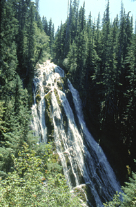
 Upper Fall Creek Falls (u)
Rating: ***
Form: fan
Magnitude: 69
Access: trail (page 291)
USGS Map: Diamond Peak (1997 ns)
Edition: 1st
Others COPYRIGHT 2013 by Gregory A. Plumb
Use the following Waterfalls for Intrepid Explorers hyperlink to access an index for information on exploring the following waterfalls:
South Verdun Rock Falls (u), USGS Mt. David Douglas (1997 nl)
Verdun Rock Falls (u), USGS Mt. David Douglas (1997 nl)
North Verdun Rock Falls (u), USGS Mt. David Douglas (1997 nl)
Go to next section of South Cascades
Go to previous section of South Cascades
South Cascades Contents
South Cascades Index
Master Table of Contents
Master Index
Perform a Selective Search
View Chronological List of Additions
View Chronological List of Updates
Place
a Book Order Online
GUIDEBOOK published by
Mountaineers Books