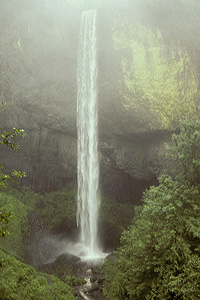
 Latourell Falls
Rating: *****
Form: plunge
Magnitude: 83
Access: auto (page 201)
USGS Map: Bridal Veil (1994)
Edition: 1st
Latourell Falls
Rating: *****
Form: plunge
Magnitude: 83
Access: auto (page 201)
USGS Map: Bridal Veil (1994)
Edition: 1st
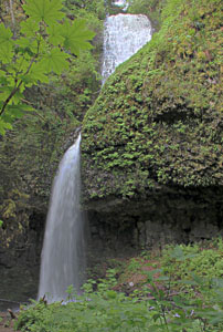 Upper Latourell Falls
Rating: ***
Form: tiered
Magnitude: 65
Access: trail (page 201)
USGS Map: Bridal Veil (1994)
Edition: 1st
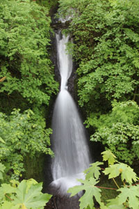 Sheppards Dell Falls
Rating: **
Form: tiered
Magnitude: 30 (l)
Access: auto (page 202)
USGS Map: Bridal Veil (1994 nl)
Edition: 2nd
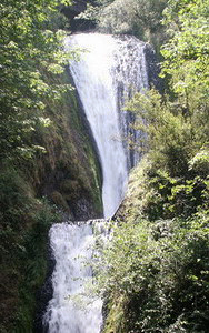 Bridal Veil Falls
Rating: ***
Form: tiered
Magnitude: 59
Access: trail (page 202)
USGS Map: Bridal Veil (1994)
Edition: 1st
 Coopey Falls
Rating: *
Form: horsetail
Magnitude: 59
Access: trail
USGS Map: Bridal Veil (1994)
Edition: 1st
Update:
Now only partial views are available of the falls from Angels Rest Trail 415.
Others
Use the following Waterfalls for Intrepid Explorers hyperlink to access an index for information on exploring the following waterfalls:
Middle Bridal Veil Falls, USGS Bridal Veil (1994 ns) and
Upper Bridal Veil Falls, USGS Bridal Veil (1994 nl)
COPYRIGHT 2021 by Gregory A. Plumb
GUIDEBOOK published by
Mountaineers Books