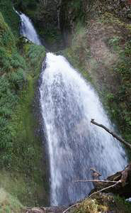
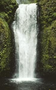
 Wahkeena Falls
Rating: ****
Form: tiered
Magnitude: 59
Access: auto (page 203)
USGS Map: Bridal Veil (1994)
Edition: 1st
Wahkeena Falls
Rating: ****
Form: tiered
Magnitude: 59
Access: auto (page 203)
USGS Map: Bridal Veil (1994)
Edition: 1st
 Necktie Falls
Rating: **
Form: horsetail
Magnitude: 49
Access: trail (page 204)
USGS Map: Multnomah Falls (1994 ns)
Edition: 1st
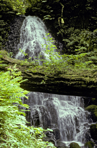 Fairy Falls
Rating: ***
Form: fan
Magnitude: 45
Access: trail (page 205)
USGS Map: Multnomah Falls (1994 ns)
Edition: 1st
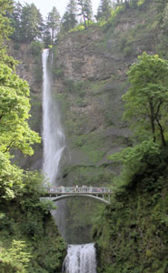 Multnomah Falls
Rating: *****
Form: plunge
Magnitude: 93
Access: auto (page 205)
USGS Map: Multnomah Falls (1994 nl)
Edition: 1st
 Lower Multnomah Falls
Rating: ***
Form: horsetail
Magnitude: 55
Access: auto (page 205)
USGS Map: Multnomah Falls (1994 nl)
Edition: 1st
 Dutchman Falls (u)
Rating: **
Form: block
Magnitude: 37
Access: trail (page 206)
USGS Map: Multnomah Falls (1994 ns)
Edition: 1st
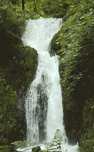
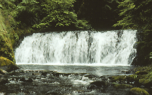
 Weisendanger Falls
Rating: ***
Form: plunge
Magnitude: 62
Access: trail (page 206)
USGS Map: Multnomah Falls (1994 ns)
Edition: 1st
Image courtesy of Greg Lief
 Mist Falls
Rating: **
Form: tiered
Magnitude: 17 (t)
Access: auto (page 206)
USGS Map: Bridal Veil (1994)
Edition: 1st
More
Click Here for Little Multnomah Falls (u), USGS Multnomah Falls (1994 ns).
Click Here for Upper Multnomah Falls (u), USGS Multnomah Falls (1994 ns).
Output the CLICK HERE pages to match your hardcopy book by changing your printer settings to 9" x 5 3/4".
Others
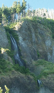
Only the top of Ecola Falls, USGS Multnomah Falls (1994 ns), is visible from the trail.
COPYRIGHT 2013 by Gregory A. Plumb
GUIDEBOOK published by
Mountaineers Books