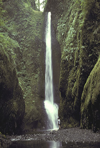
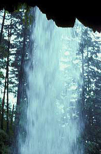
 Lower Oneonta Falls (u)
Rating: ***
Form: plunge
Magnitude: 49
Access: bushwhack (page 208)
USGS Map: Multnomah Falls (1994 ns)
Edition: 3rd
Update: Due to hazardous conditions, bushwhacking to this waterfall is no longer permitted.
Lower Oneonta Falls (u)
Rating: ***
Form: plunge
Magnitude: 49
Access: bushwhack (page 208)
USGS Map: Multnomah Falls (1994 ns)
Edition: 3rd
Update: Due to hazardous conditions, bushwhacking to this waterfall is no longer permitted.
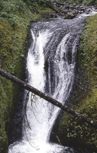 Middle Oneonta Falls (u)
Rating: **
Form: horsetail
Magnitude: 63
Access: trail (page 208)
USGS Map: Multnomah Falls (1994 ns)
Edition: 1st
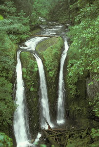 Triple Falls
Rating: *****
Form: segmented
Magnitude: 71
Access: trail (page 208)
USGS Map: Multnomah Falls (1994)
Edition: 1st
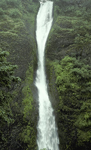 Horsetail Falls
Rating: ****
Form: horsetail
Magnitude: 82 (h)
Access: auto (page 208)
USGS Map: Multnomah Falls (1994)
Edition: 1st
 Ponytail Falls
Rating: ***
Form: horsetail
Magnitude: 76 (h)
Access: trail (page 209)
USGS Map: Multnomah Falls (1994 ns)
Edition: 1st
Others
Conditions are now reportedly too dangerous to attempt an off-the-main-trail trek to Oneonta Falls, USGS Multnomah Falls (1994).
COPYRIGHT 2024 by Gregory A. Plumb
GUIDEBOOK published by
Mountaineers Books