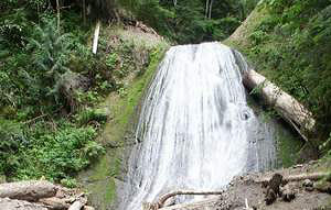
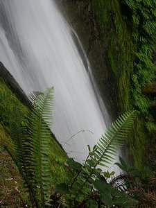
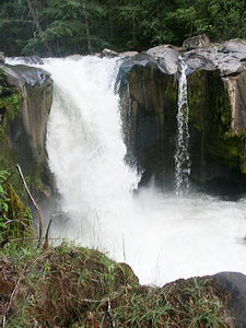
 Bridal Falls (u)
Rating: **
Form: fan
Magnitude: 41
Access: trail & bushwhack (page 146)
USGS Map: Tower Rock (1994 ns)
Edition: 4th
Bridal Falls (u)
Rating: **
Form: fan
Magnitude: 41
Access: trail & bushwhack (page 146)
USGS Map: Tower Rock (1994 ns)
Edition: 4th
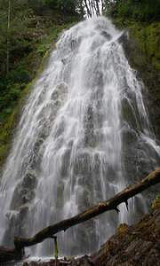
 Angel Falls
Rating: ***
Form: horsetail
Magnitude: 30 (l)
Access: trail (page 147)
USGS Map: Tower Rock (1994 ns)
Edition: 4th
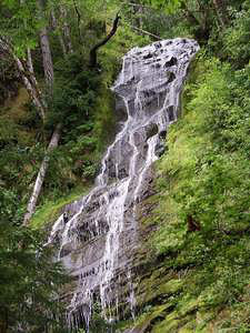
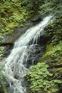
 Covell Creek Falls
Rating: ***
Form: plunge
Magnitude: 54
Access: trail (page 147)
USGS Map: Tower Rock (1994 nl)
Edition: 4th
 Galena Falls (u)
Rating: ***
Form: fan
Magnitude: 53
Access: bushwhack (page 149)
USGS Map: Tower Rock (1994 nl)
Edition: 4th
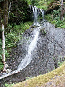
 Camp Creek Falls
Rating: **
Form: horsetail
Magnitude: 48
Access: trail (page 149)
USGS Map: Keel Mtn (1984 nl)
Edition: 4th
 Yozoo Creek Falls
Rating: **
Form: fan
Magnitude: 18 (l)
Access: auto (page 149)
USGS Map: Blue Lake (1994 ns)
Edition: 1st
 Twin Creek Falls (u)
Rating: **
Form: tiered
Magnitude: 20
Access: auto (page 149)
USGS Map: East Canyon Ridge (1994 ns)
Edition: 5th
 Whitewater Falls (u)
Rating: **
Form: punchbowl
Magnitude: 28
Access: trail (page 150)
USGS Map: East Canyon Ridge (1994 ns)
Edition: 5th
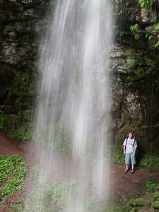
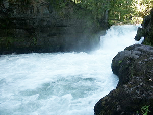
 Erics Falls (u)
Rating: ***
Form: punchbowl
Magnitude: 50 (h)
Access: trail (page 150)
USGS Map: East Canyon Ridge (1994 ns)
Edition: 5th
More
Click Here for Lower Galena Falls (u), USGS Tower Rock (1994 ns).
Click Here for Washout Falls (u), USGS Tower Rock (1994 ns).
Click Here for Initial Falls (u), USGS Blue Lake (1994 ns).
Click Here for Grouse Creek Falls (u), USGS Blue Lake (1994 nl).
Click Here for Cathedral Falls, aka Echo Falls (u), USGS Vanson Peak (1998 ns).
Click Here for Cowlitz Falls , USGS Cowlitz Falls (1994).
Output the CLICK HERE pages to match your hardcopy book by changing your printer settings to 9" x 5 3/4".
Others
Although near a road, Cispus River Falls (u), USGS East Canyon Ridge (1994 ns) was not found to be readily accessible when last surveyed in 2006.
COPYRIGHT 2013 by Gregory A. Plumb
GUIDEBOOK published by
Mountaineers Books