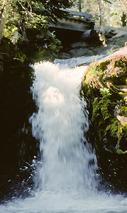
 Bird Creek Falls
Rating: **
Form: tiered
Magnitude: 16 (h)
Access: auto (page 177)
USGS Map: King Mtn (2000 ns)
Edition: 2nd
Bird Creek Falls
Rating: **
Form: tiered
Magnitude: 16 (h)
Access: auto (page 177)
USGS Map: King Mtn (2000 ns)
Edition: 2nd
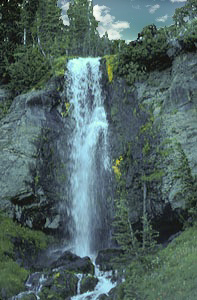 Crooked Creek Falls
Rating: ***
Form: horsetail
Magnitude: 50
Access: trail (page 177)
USGS Map: Mount Adams East (2000)
Edition: 2nd
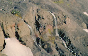 Hellroaring Falls
Rating: **
Form: segmented
Magnitude: 68
Access: auto or trail (page 177)
USGS Map: Mount Adams East (2000 nl)
Edition: 2nd
Others
Use the following Waterfalls for Intrepid Explorers hyperlink to access an index for information on exploring the following waterfall yet to be visited by the author:
Lower Hellroaring Falls (u), USGS Mount Adams East (2000 nl)
It is likely too tough to find Rusk Creek Falls (u), USGS Mount Adams East (2000 nl), and
Upper Rusk Creek Falls (u), USGS Mount Adams East (2000 nl).
All of the following cataracts are located within tracts of Yakama Indian Reservation that are permanently closed to the public:
Castile Falls, USGS Castile Falls (1970), West Fork Falls (u), USGS Windy Point (1970 nl), Klickitat Falls (u), USGS Signal Peak (1970 nl), Lower Klickitat Falls (u), USGS Signal Peak (1970 nl), and
Coyote Creek Falls (u), USGS Fairview Ridge (2000 nl).
COPYRIGHT 2013 by Gregory A. Plumb
GUIDEBOOK published by
Mountaineers Books