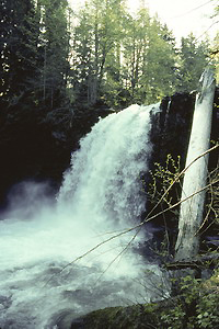
June Lake Falls (u)
Rating: ***
Form: plunge
Magnitude: 61
Access: trail (page 126)
USGS Map: Mount St Helens (1983 ns)
Upper Lava Canyon Falls (u)
Rating: **
Form: plunge
Magnitude: 51 (h)
Access: trail (page 126)
USGS Map: Smith Creek Butte (1983 nl)
Triplet Falls (u)
Rating: ***
Form: tiered
Magnitude: 47 (h)
Access: trail (page 127)
USGS Map: Smith Creek Butte (1983 ns)
Double Punchbowl Falls (u)
Rating: **
Form: tiered
Magnitude: 40 (h)
Access: trail (page 127)
USGS Map: Smith Creek Butte (1983 ns)
Lava Canyon Falls (u)
Rating: *****
Form: tiered
Magnitude: 81 (h)
Access: trail (page 127)
USGS Map: Smith Creek Butte (1983 ns)
Middle Lava Canyon Falls (u)
Rating: ***
Form: tiered
Magnitude: 66 (h)
Access: trail (page 127)
USGS Map: Smith Creek Butte (1983 ns)
Lower Lava Canyon Falls (u)
Rating: **
Form: tiered
Magnitude: 70 (h)
Access: trail (page 128)
USGS Map: Smith Creek Butte (1983 ns)
Others
Update: A trail guide for Mount St. Helens National Monument mentions Loowit Trail passing by the 40-foot drop of Chocolate Falls, Mount St Helens (1983 ns).
Smith Creek Falls (u) and West Smith
Creek Falls (u), both USGS Smith Creek Butte (1983 nl), are not likely
accessible.
Copyright 2008 by Gregory A. Plumb
GUIDEBOOK published by
Mountaineers Books